Tuyển tập Hội nghị Khoa học thường niên năm 2015. ISBN: 978-604-82-1710-5
xiii
FLOOD CONTROL MEASURES IN THE LOWER
DONG NAI - SAI GON RIVER BASIN
Nguyen Quang Kim1, Le Xuan Bao1, Le Trung Thanh1, Trieu Anh Ngoc1
1Thuyloi University, Vietnam
ABSTRACT
The lower Dong Nai - Sai Gon river basin plays a significant role in Vietnam's economic
development. In the basin, Ho Chi Minh (HCM) City is known as the biggest center with a fast
growing economy and increasing population. However, this area is undergoing inundation
problems caused by upstream floods, heavy rains and changes in sea levels. Flooding control in
this area has been subject to many studies and thus a number of measures was proposed, such as
the hydraulic construction system (1547/QĐ-TTg), sea dike from Vung Tau to Go Cong, sea dike
from Can Gio to Go Cong and so on. However, the effectiveness of such measures have not been
analyzed and compared. This study applies one large scale 1-D hydrodynamic model and GIS
techniques to clarify and assess the ability of flood control measures. Three sea level rise
scenarios for Vietnam are also taken into account. The computed results with sea level rise show
that the current hydraulic construction system (1547/QĐ-TTg) can control floods but in the
future, an integrated measure with the Can Gio - Go Cong sea dike is the most effective one in
controling flood in this area.
Keywords: Sai Gon - Dong Nai river, flood control, inundation, sea level rise (SLR)
1. INTRODUCTION
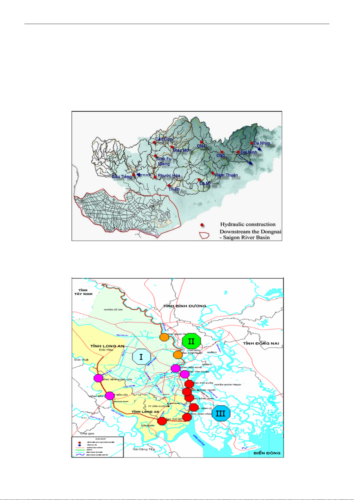
The lower Dong Nai - Sai Gon river
(LDSR) basin (Fig. 1) spreads over a wide
area, including Ho Chi Minh City (HCMC)
and six provinces of Binh Duong, Dong Nai,
Tay Ninh, Long An, Dong Thap, Tien Giang,
with a total area of 1,080,520 hectares. It is a
lowland, adjacent to the East Sea of Vietnam.
This lowland is strongly influenced by river
flows and tides . In recent years, many large
reservoirs have been constructed in the
upstream. Salt water intrusion and lack of
fresh water are also the problems of this area.
Being affected by climate change and sea
level rise, salinity intrusion, inundation and
flooding in the LDSR have became more
serious. Extreme rainfall on the Dong Nai -
Sai Gon River Basin in HCMC area,
combining the high tides - rising sea levels
will progressively put pressure on the
drainage system and increased flooding to
HCMC in the near future.
A number of flood control measures was
proposed as summarized below. One of those
measures introduced the construction of a
hydraulic system along the Sai Gon River
and main canals. This solution was approved
by Vietnamese Goverment (under decision
1547/QĐ-TTg) and focuses only on
protecting the downtown area of HCM city.
Thus, it does not fully solve the flooding
problems in the whole area downstream of
the Dong Nai - Sai Gon River. In efforts to
find a more comprehensive solution, the idea
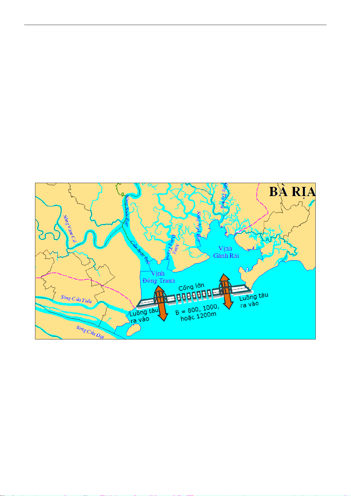
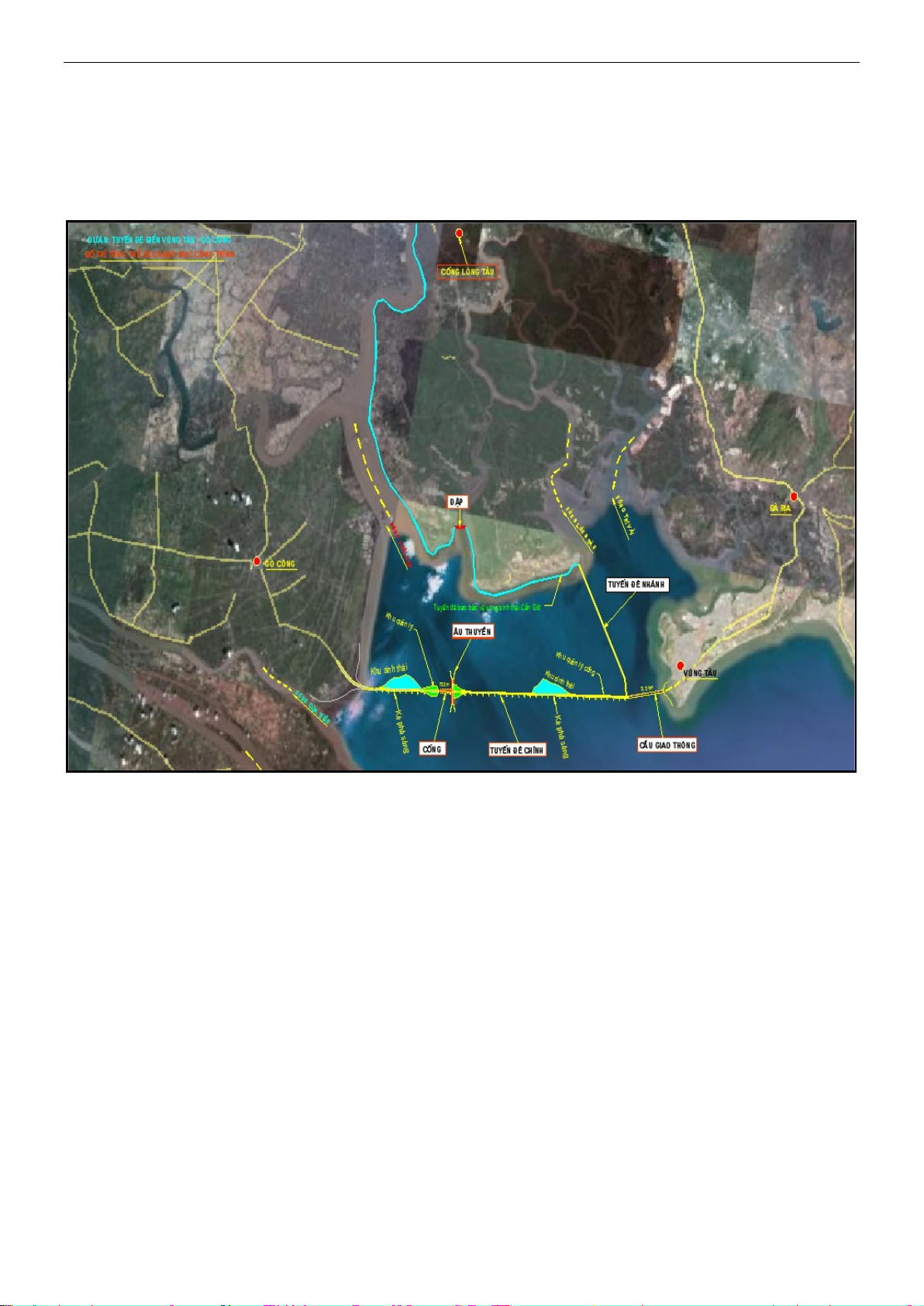
of the sea dike from Vung Tau to Go Cong
was proposed. This sea dike can control
flooding and prevent the sea level rise, but it
can cause potential problem of environment;