Copyright © 2024 | nguyenduyliem@hcmuaf.edu.vn Quản lý lưu vực
Nội dung
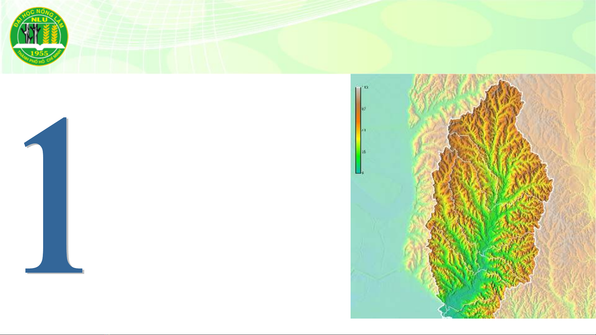
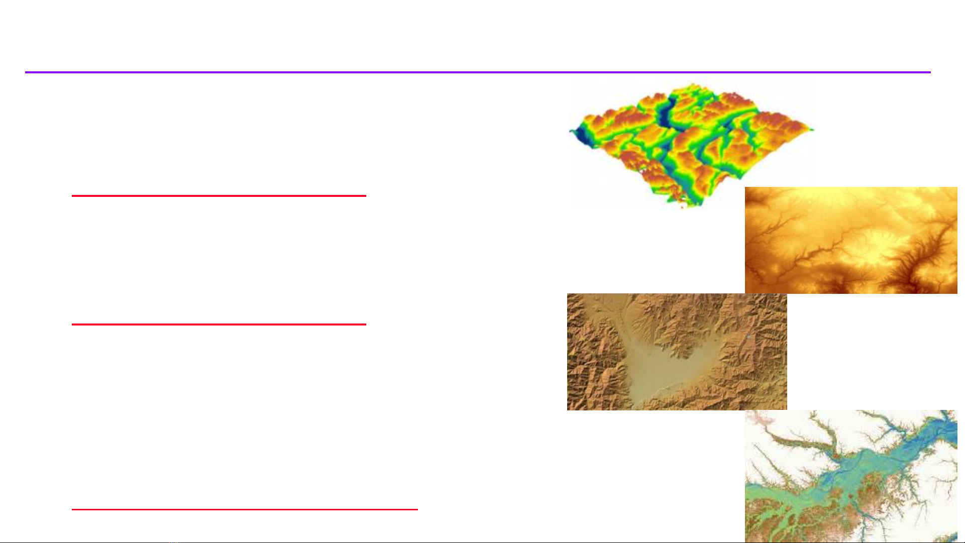
Thu thập DEM (Acquiring DEM)
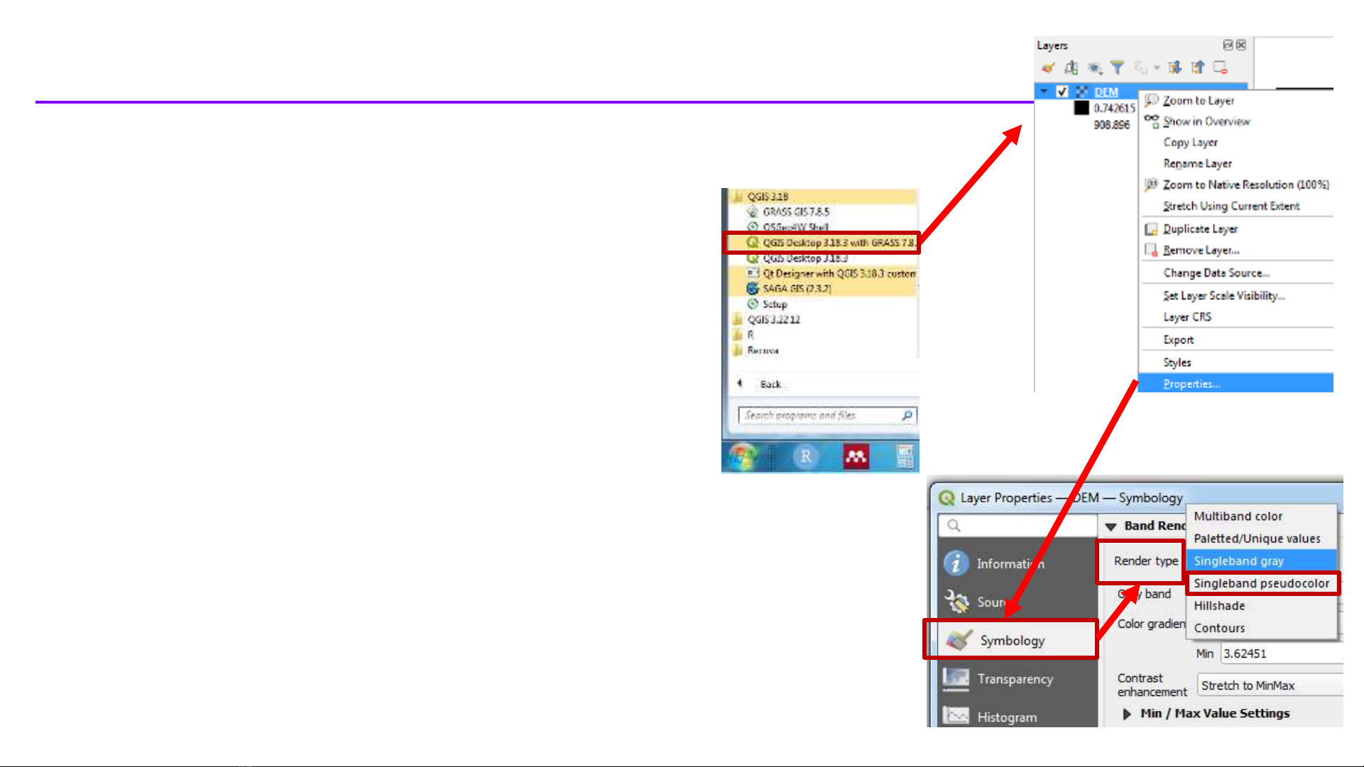
Thêm DEM vào QGIS Desktop with
GRASS (Add DEM into QGIS Desktop with GRASS)
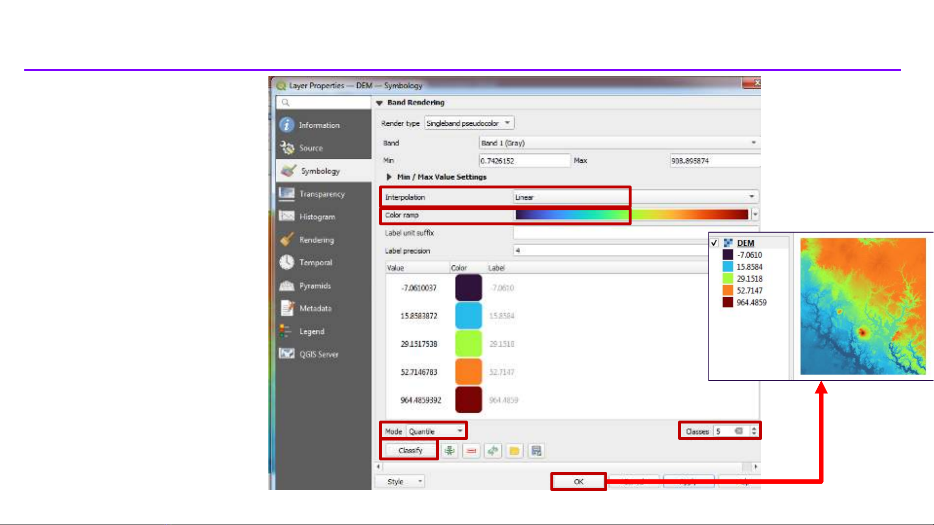
Tạo hiệu ứng đổ bóng trên DEM (Create
hillshade effect on DEM)
Thêm bản đồ nền từ phần mở rộng
HCMGIS (Add basemap from HCMGIS plugin)
Lấp đầy điểm trũng trong DEM (Fill sinks in
the DEM)
Xác định hướng dòng chảy và tính dòng
chảy tích lũy (Calculate flow direction and flow
accumulation)
Phác họa mạng lưới sông suối (Delineate
the streams)
Phác họa ranh giới lưu vực (Delineate the
watershed boundary)
Cắt DEM, mạng lưới sông suối theo ranh
giới lưu vực (Clip DEM, streams to the watershed
boundary)
Xác định sông suối thượng nguồn, trung
lưu, hạ nguồn (Identify upstream, midstream, and
downstream rivers)
Hiển thị 3D của DEM, mạng lưới sông
suối (3D Modeling of DEM, streams)
2