Seismic hazard assessment
-
Part 1 of ebook "Advances in performance-based earthquake engineering" has presents the following content: ground motions for performance-based earthquake engineering; mapping seismic hazard for the needs of displacement-based design; theoretical consistency of common record selection strategies in performance-based earthquake engineering; performance-based seismic design and retrofitting methodologies; new concept on fail-safe design of foundation structure systems insensitive to extreme motions;...
 275p
275p  dieptieuung
 19-07-2023
 2
2
 2
2
 Download
-
This paper presents the probabilistic seismic hazard assessment (PSHA) results for Da Nang city. A regional earthquake catalog was updated until 2021 and comprehensive seismic source zones within 150 km of Da Nang city were used.
 18p
18p  viironman
 02-06-2023
 8
8
 3
3
 Download
-
In this study, we have carried out the probabilistic seismic hazard analysis in Hanoi based on the latest seismotectonic data. The seismic hazard map shows peak ground acceleration values on rock corresponding to the 10% probability of exceedance in a 50-year time period (approximately return periods of 500 years).
 14p
14p  vipagani
 24-10-2022
 7
7
 3
3
 Download
-
Herein, a combined analysis of Global Navigation Satellite System-derived strain rate maps, in accordance with recent seismicity, was presented to reveal that the N-S extension is accommodated primarily by strike-slip faulting of the İzmir-Balıkesir Transfer Zone (İBTZ), where a counter clockwise rotation (~25–100°/Myr) along the vertical axis is dominant. The results indicated that strike-slip segments within the İBTZ show variable transport sense and amount of slip along them, and they connect by hard linkage relay ramps with the dip to oblique slip normal faults.
 18p
18p  tanmocphong
 29-01-2022
 17
17
 1
1
 Download
-
The southern part of the Western Anatolia Extensional Province is governed by E-W-trending horst-graben systems and NW-SE-oriented active faults. The NW-striking Yatağan Fault is characterised by an almost pure normal sense of motion with a minor dextral strike slip component. Although the settlements within the area have been affected by several earthquake events since ancient times (~2000 BCE), the earthquake potential and history of the Yatağan Fault has remained unknown until a few years ago.
 21p
21p  tanmocphong
 29-01-2022
 13
13
 1
1
 Download
-
A geological interpretation of the faulting mechanism is also proposed. The existence of a new unknown source in an intermontane area is problematic. The role of inherited alpine structures seems more important today than in the past. The strike of the two new seismogenic sources, responsible for the two strongest events of the 2021 earthquake succession, differs from the previously known active faults. This forces us to reconsider older views on the direction of development of active faults and the orientation of the stress field.
 11p
11p  tanmocphong
 29-01-2022
 20
20
 0
0
 Download
-
In this study, the methodology of probabilistic seismic hazard assessment proposed by cornell and Esteva in 1968 was applied for Hanoi city, using an earthquake catalog updated until 2018 and a comprehensive seismotectonic model of the territory of Vietnam and adjacent sea areas.
 18p
18p  12120609
 22-03-2020
 22
22
 1
1
 Download
-
A comparison is made between the hazard map obtained with the neo deterministic seismic hazard assessment, using two different approaches: one based on the events magnitude, listed in parametric earthquake catalogues compiled for the study areas...
 16p
16p  12120609
 22-03-2020
 11
11
 1
1
 Download
-
The seismic risk of the NPP is further assessed by incorporation of the rate of frequency exceedance and conditional failure probability curves. Furthermore, this framework attempts to show the unacceptable performance of the isolated NPP in terms of the probabilistic distribution and annual probability of limit states. The comparative results for long and common ground motions are discussed to contribute to the future safety of nuclear facilities against drastic events like Tohoku.
 8p
8p  minhxaminhyeu5
 30-06-2019
 16
16
 2
2
 Download
-
In this paper, a practical approach was presented for performing an earthquake-induced landslide PSA for NPPs subject to seismic hazard. To demonstrate the effectiveness of the proposed approach, it was applied to Korean typical NPP in Korea as a numerical example. The assessment result revealed the quantitative probabilistic effects of peripheral slope failure and subsequent run-out effect on the risk of core damage frequency (CDF) of a NPP during the earthquake event.
 15p
15p  minhxaminhyeu3
 25-06-2019
 12
12
 0
0
 Download
-
In this paper, the results of probabilistic seismic hazard assessment (PSHA) for the Tranh river hydropower plant No 2 site, Quang Nam province, are presented. A regional earthquake catalog updated until 2014 and most recent data on active faulting in the area with a radial extent of 100 km from the HPP site were used. Applied modern techniques in the PSHA methodology including logic tree and hazard disaggregation allow to adopt different models of seismicity, seismic sources and ground motions for the study area.
 14p
14p  meolep4
 02-01-2019
 31
31
 3
3
 Download
-
In this paper, the probabilistic seismic hazard maps for the South Central Vietnam are presented. An earthquakes catalog updated until 2014 and most recent seismotectonic and geodynamic information were used for delineation of 14seismic source zones in the study area. The Toro et al. (1997) attenuation equation was used for the PSHA. The hazard maps show distribution of the mean peak ground acceleration (PGA) with a 10%, 5%, 2% and 0.5% probability of exceedance in 50 years.
 0p
0p  meolep4
 02-01-2019
 22
22
 1
1
 Download
-
Results of our survey of the area around Song Tranh 2 (December 2012) have shown that recently, the earthquakes occur frequently and caused minor damage on some houses. While the houses had cracks in the walls, but the columns did not experience any damage. The damage is consistent with the shaking of the intensity in the range of VI - VII (MSK scale).
 0p
0p  meolep4
 02-01-2019
 34
34
 1
1
 Download
-
This is the first time the LPI based method was applied for evaluation of earthquake-induced liquefaction for Hanoi city. The most advantage of the method is that it can be easy to use, although the reliability of the results depends very much on number and distribution of the borehole data. Nevertheless, the combination of this method with other available methods can help effectively solving the problem of urban seismic risk assessment for the mega-cities in Vietnam.
 19p
19p  meolep1
 28-11-2018
 23
23
 1
1
 Download
-
This paper describes the development of a Decision support system (DSS) for earthquake warning service in Vietnam using Web GIS technology. The system consists of two main components: (1) an on-line database of earthquakes recorded from the national seismic network of Vietnam, and (2) a set of tools for rapid seismic hazard assessment. Using an on-line earthquake database, the system allows creating a shake map caused by a newly recorded earthquake.
 14p
14p  meolep1
 28-11-2018
 35
35
 0
0
 Download
-
The mitigation of earthquake-related hazards represents a key role in the modern society. The mitigation of such kind of hazards spans from detailed studies on seismicity, evaluation of site effects, and seismo-induced landslides, tsunamis as well as and the design and analysis of structures to resist such actions. The study of earthquakes ties together science, technology and expertise in infrastructure and engineering in an effort to minimize human and material losses when they inevitably occur.
 308p
308p  haiduong_1
 15-04-2013
 70
70
 18
18
 Download
-
The Alaskan-Aleutian arc has a history of rupturing in large and great earthquakes. The most recent sequence began in 1938 and has ruptured almost the entire arc from southern Alaska to the western Aleutians (Figure 1). This sequence includes five great earthquakes: the 1938 Alaskan, 1946 Aleutian, 1957 (Central) Aleutian, 1964 Prince William Sound (or Alaskan), and 1965 Rat Islands earthquakes. Three of these five-the 1957, 1964, and 1965 earthquakes-are among the 10 largest earthquakes of the 20th century. These earthquakes are clearly important to those who assess seismic hazards.
 229p
229p  hotmoingay
 04-01-2013
 44
44
 5
5
 Download
-
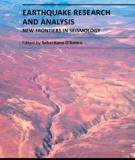
The study of earthquakes combines science, technology and expertise in infrastructure and engineering in an effort to minimize human and material losses when their occurrence is inevitable. This book is devoted to various aspects of earthquake research and analysis, from theoretical advances to practical applications. Different sections are dedicated to ground motion studies and seismic site characterization, with regard to mitigation of the risk from earthquake and ensuring the safety of the buildings under earthquake loading.
 392p
392p  cucdai_1
 16-10-2012
 74
74
 16
16
 Download
-
This book sheds lights on recent advances in Geotechnical Earthquake Engineering with special emphasis on soil liquefaction, soil-structure interaction, seismic safety of dams and underground monuments, mitigation strategies against landslide and fire whirlwind resulting from earthquakes and vibration of a layered rotating plant and Bryan's effect.
 0p
0p  cucdai_1
 16-10-2012
 75
75
 12
12
 Download
CHỦ ĐỀ BẠN MUỐN TÌM


